The Evolution of the Townships
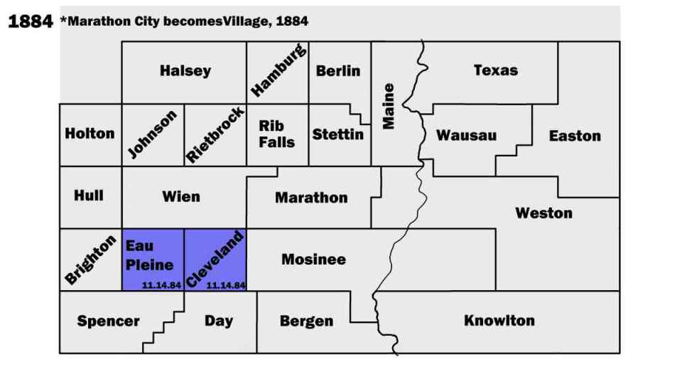
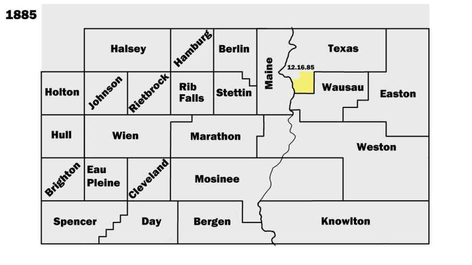
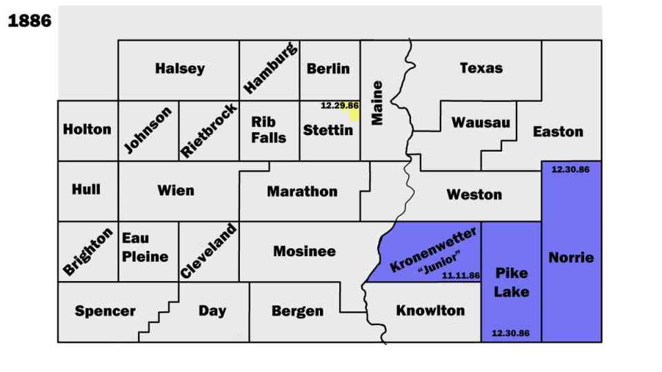
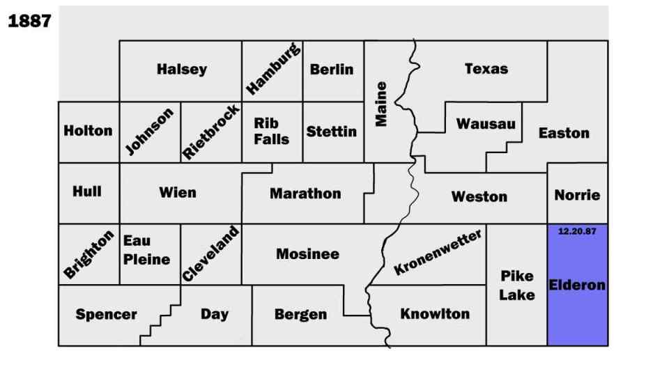


The Townships
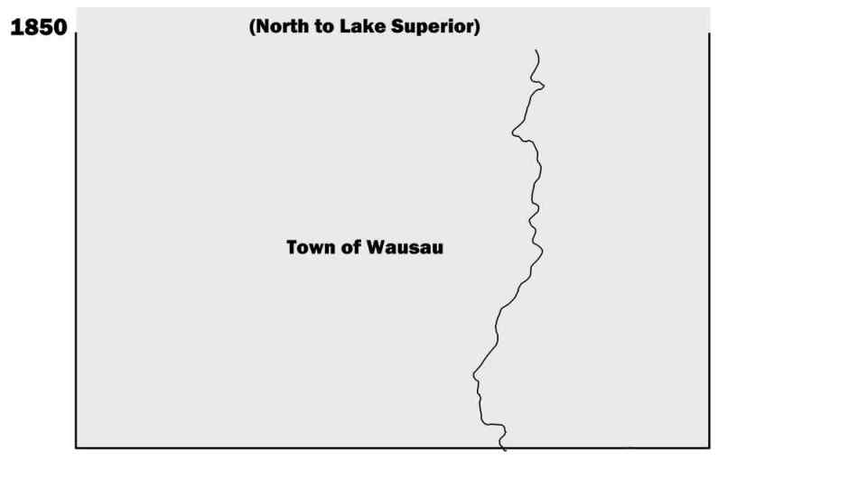
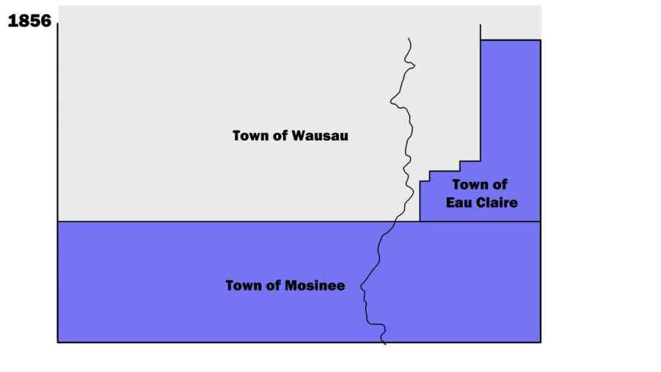
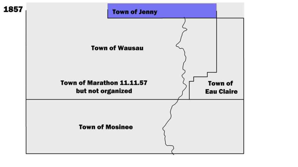
Townships (or Towns) are the most local level of representative government in Wisconsin, and largely reflects the rural parts of the County. Today the townships largely fit into the six by six mile squares, or "Jeffersonian Grids," that used to survey the land back in the 1850s.
But in the early years of the County's existance, there was so few people that there was no point in creating all of the towns before there were people living there.
The result is that by looking at the order and timing of the townships being formed and the borders being, it shows the development of the County itself.
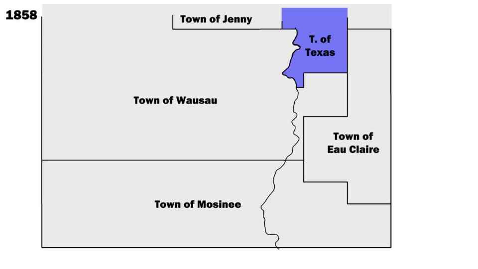
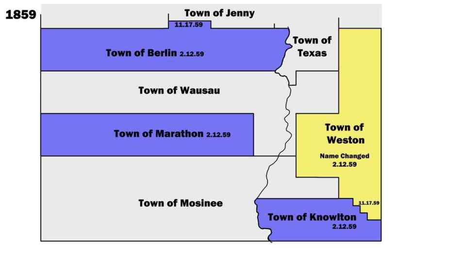
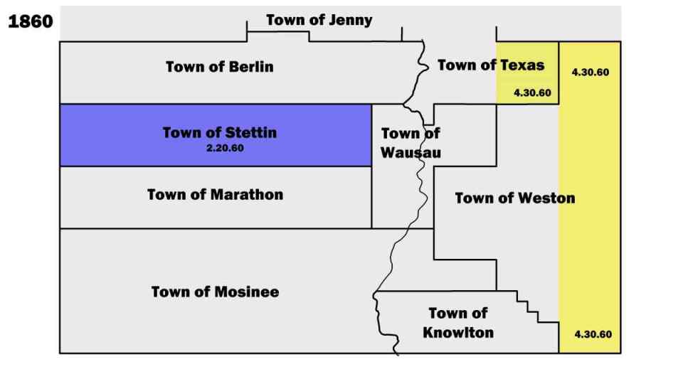
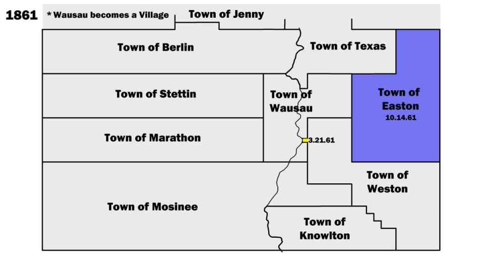
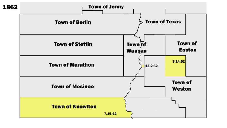
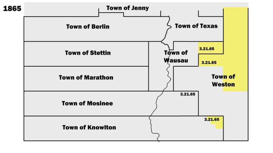
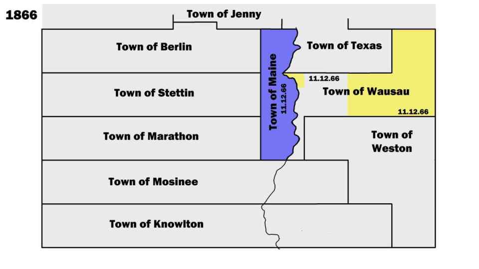
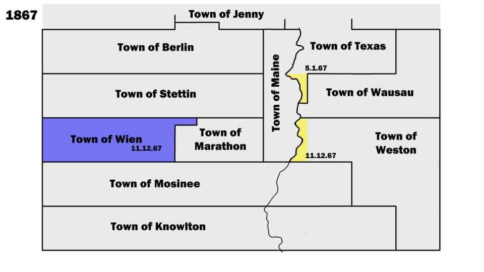
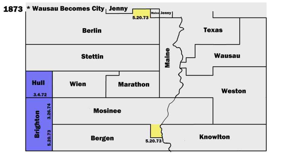
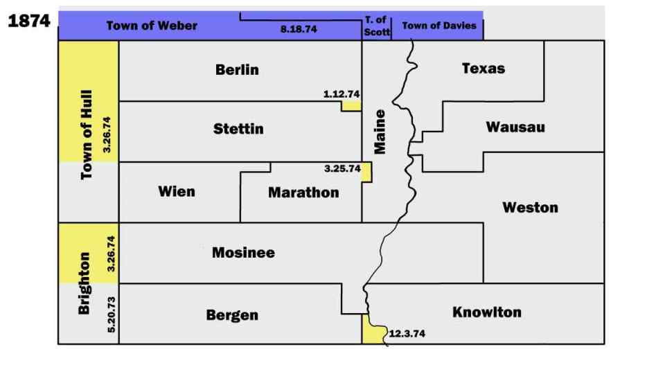
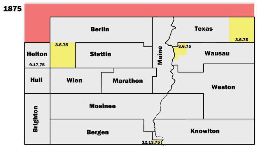
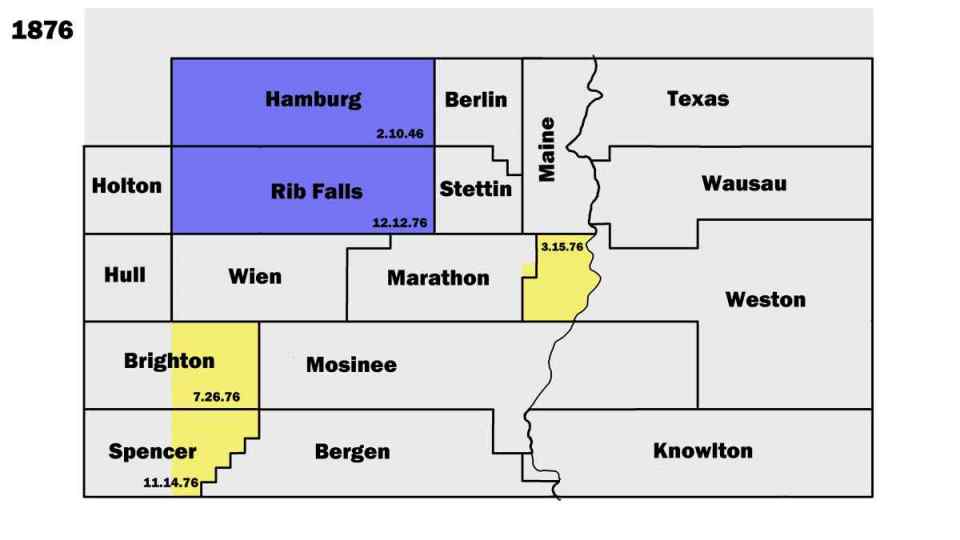
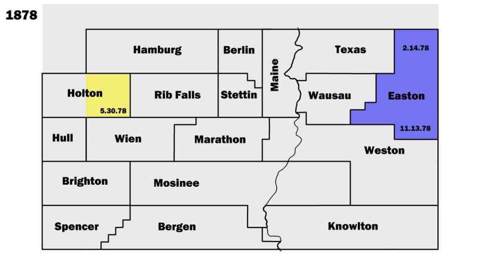
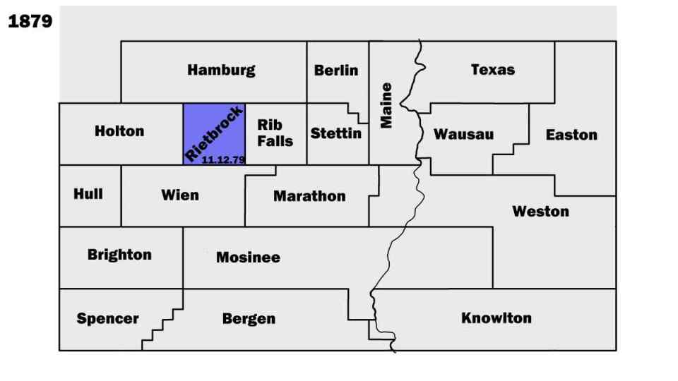
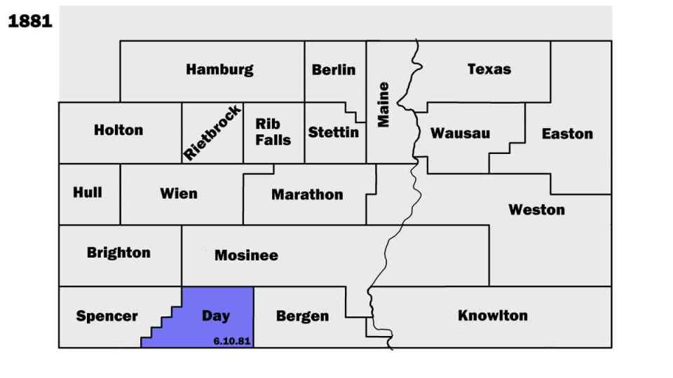
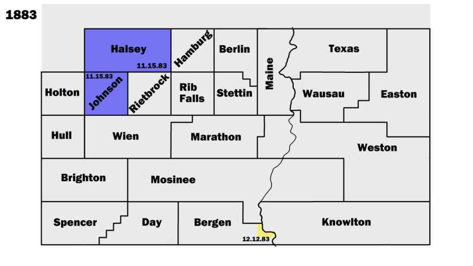
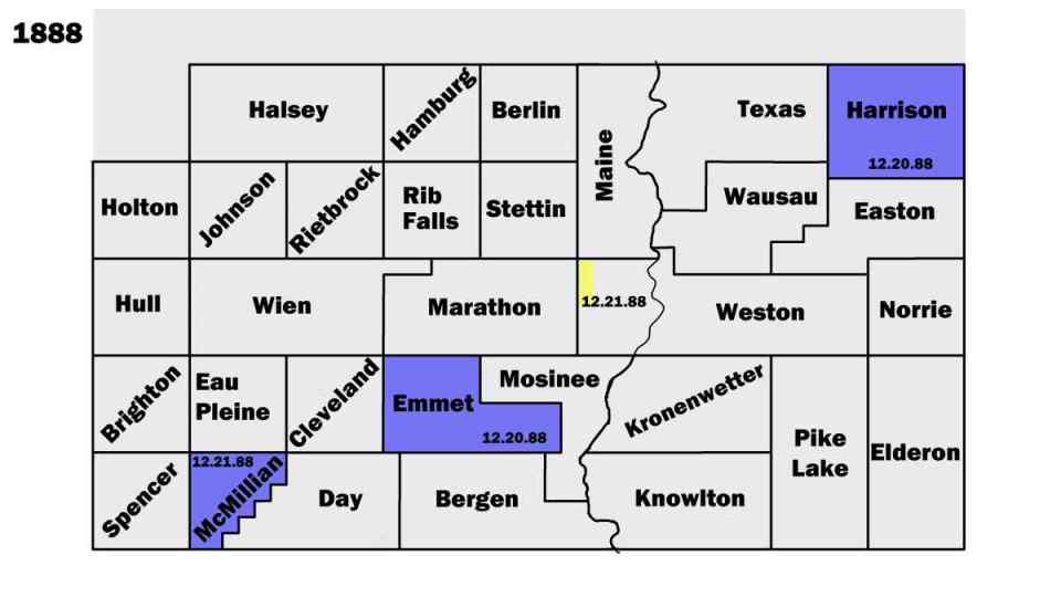
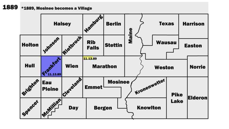
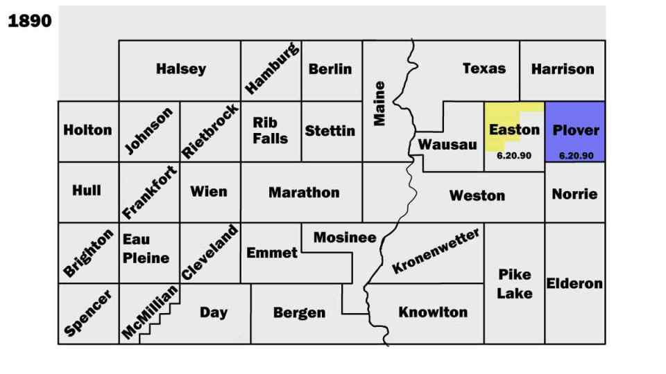
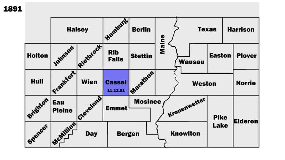
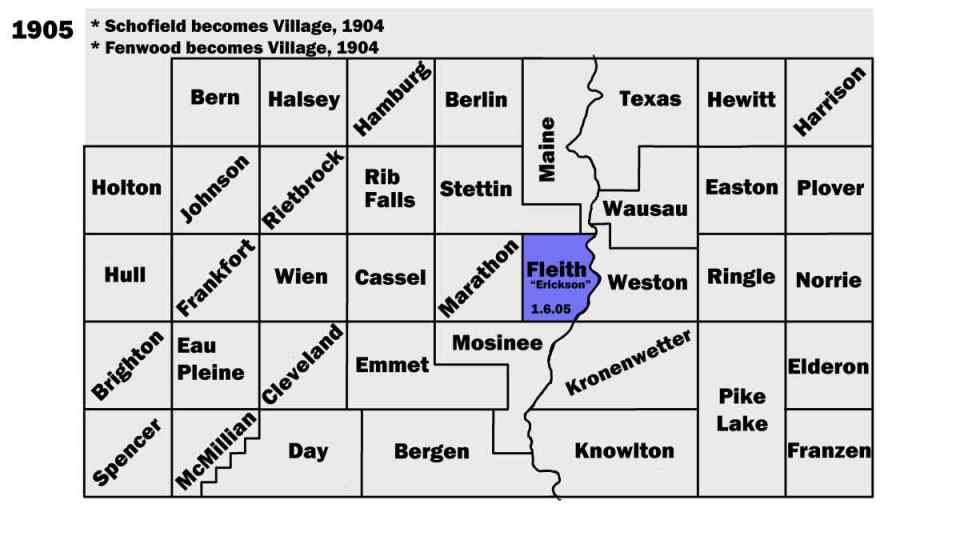
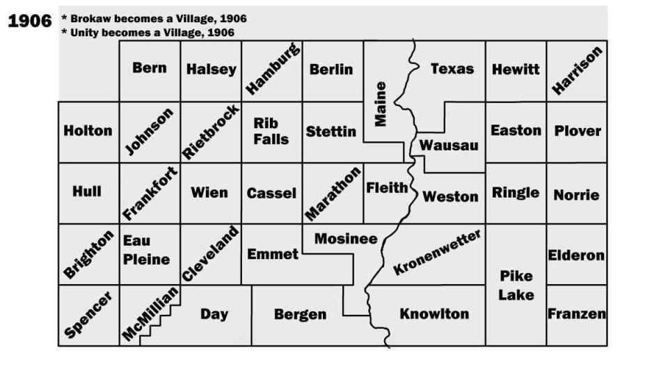
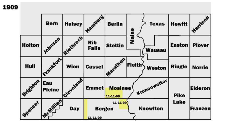
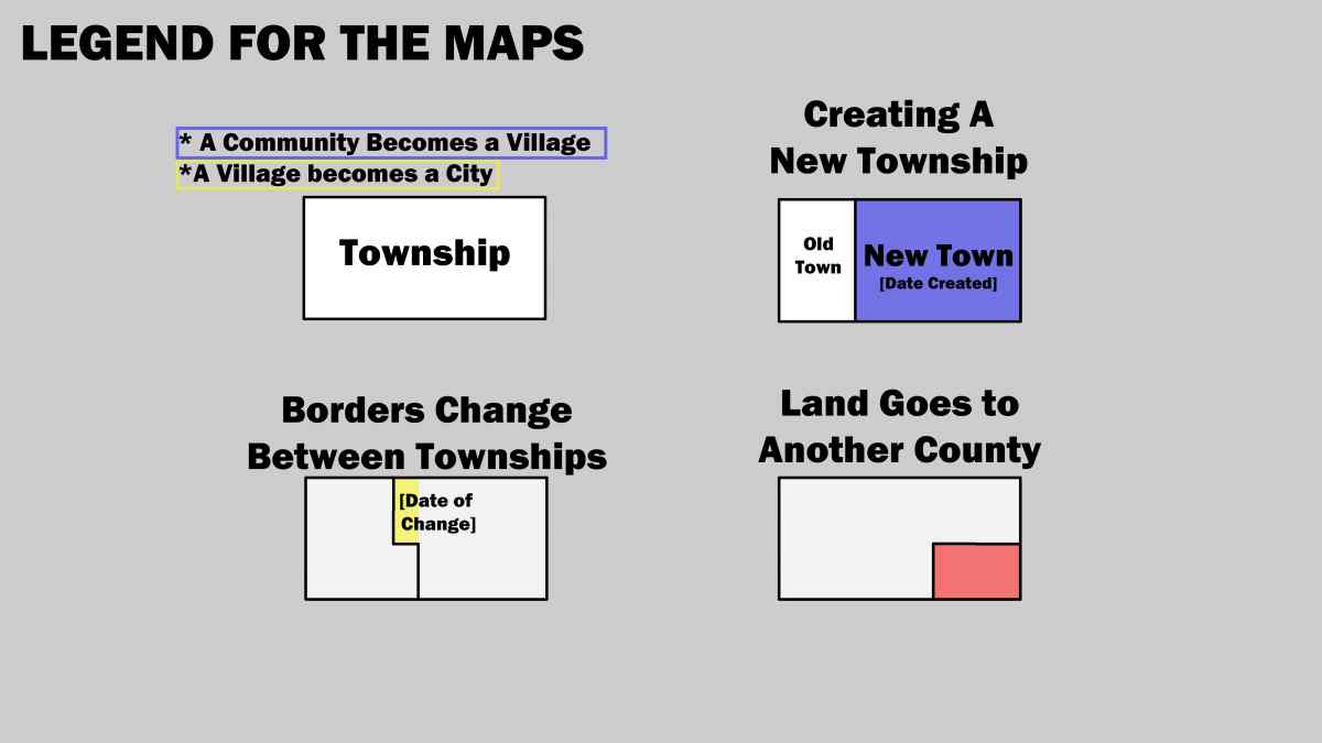
The Maps
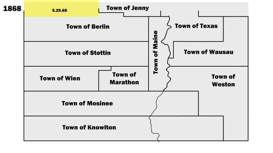
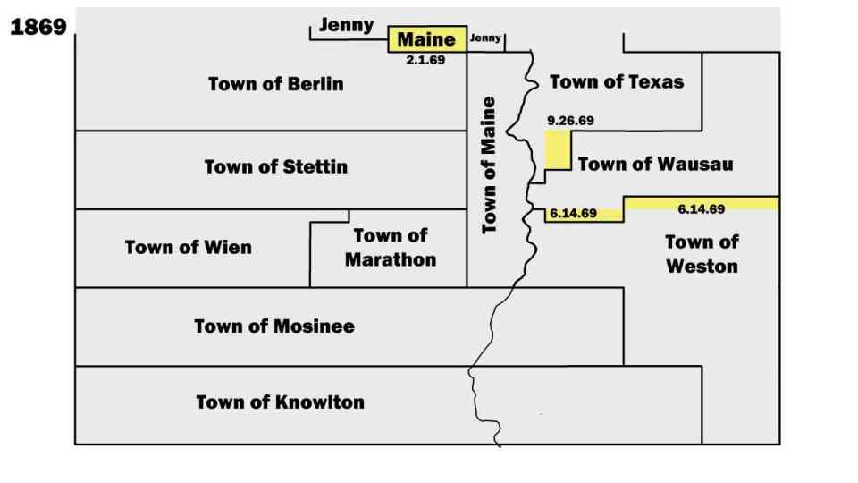
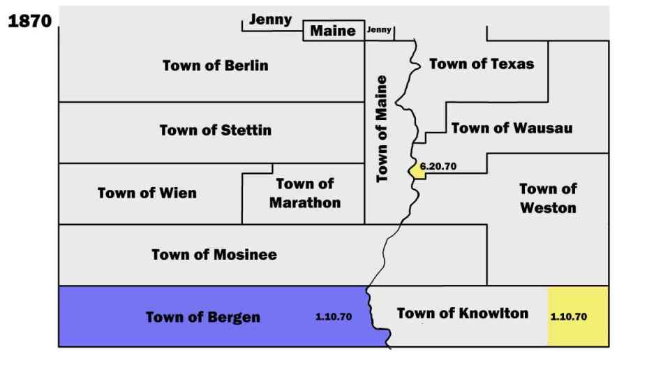
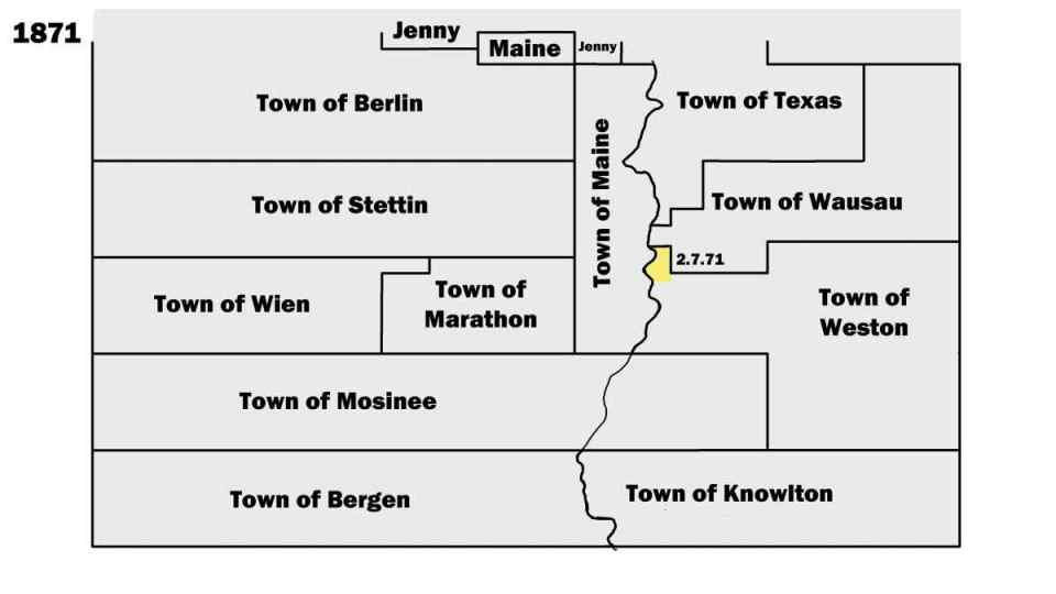
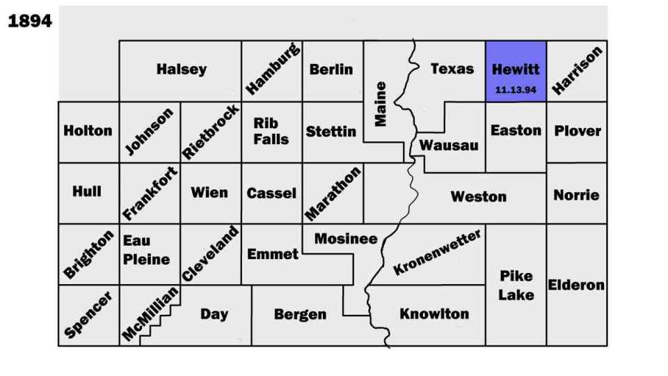
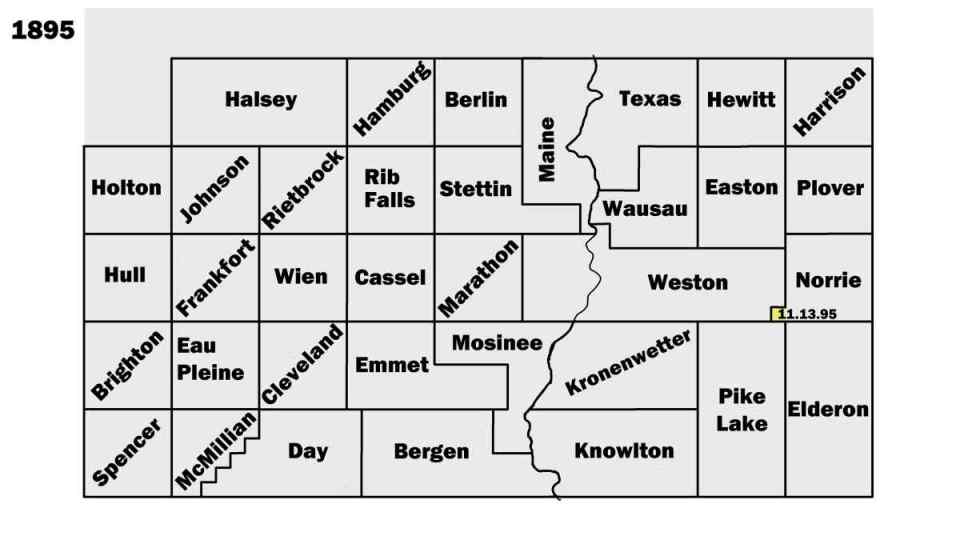
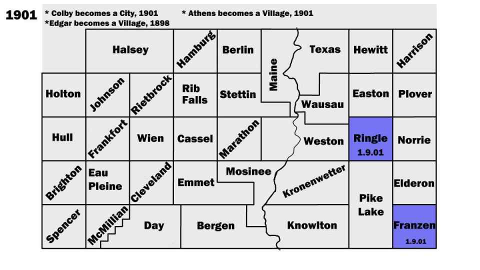
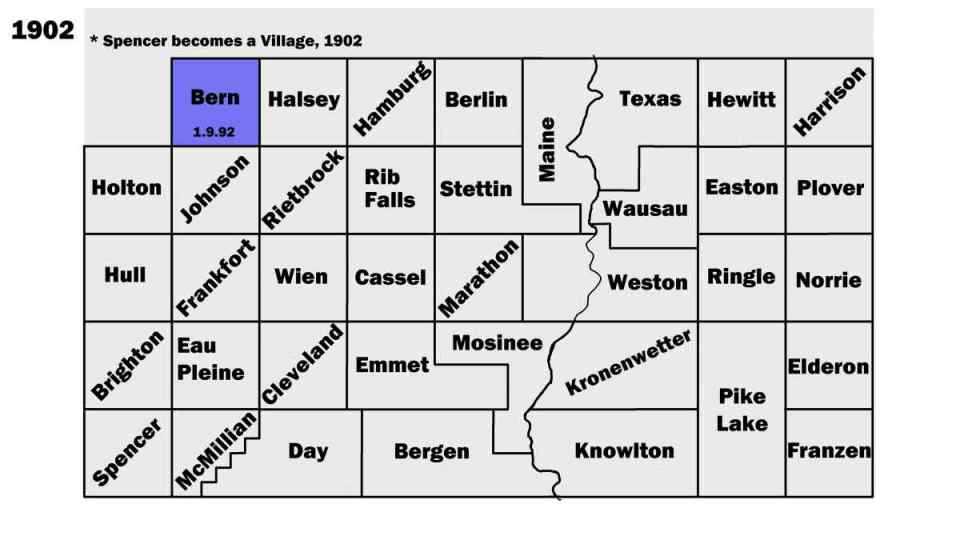
In 1964, Calvin Cook surveyed the historical records to create a year-by-year record of the creation and changes to the Marathon County's townships between 1850, and 1910. While it was created for the County's Highway Department, it has become a helpful historical document to visualize the settlement and development of the County.
The original document was been reworked into a digital format here by archivist Ben Clark in 2020.